Temperatures higher than 42°C (107.6°F) can kill flying-foxes ('fruit bats'; Pteropus sp.) at sometimes biblical scales. For example, on just one extremely hot day in January 2014, at least 45,500 flying-foxes died in 52 camps in southeast Queensland (Australia), wiping out about half of all black flying-foxes (Pteropus alecto) that were present in the affected area. In November 2018, approximately 23,000 spectacled flying-foxes (P. conspicillatus) died during a single heat event in Far North Queensland. These deaths represented about one-third of Australia's entire spectacled flying-fox population, raising serious concerns regarding the conservation of this now-endangered species.
To aid wildlife rehabilitators, land managers, and other stakeholders in coping with such events, our team at Western Sydney University and the University of Melbourne developed the Flying-Fox Heat Stress Forecaster (see our paper in Animal Conservation). The current system predicts which known flying-fox camps are likely to experience heat-stress conditions up to seven days ahead.
Outputs include an interactive national map, hourly and daily forecast playback, camp-specific temperature profiles, predicted heat stress times, information on camps on alert and shareable map products. The latest available camp count and its date are also shown to help users interpret the likely scale of exposure and the currency of that information. Together, these products support preparedness, camp checking and response coordination by indicating where and when heat-related impacts are most likely to occur, to facilitate efficient allocation of resources and help minimise impacts on human communities and flying-foxes alike.
Welcome to the new Flying-Fox Heat Stress Forecaster!
We are pleased to launch the rebuilt Flying-Fox Heat Stress Forecaster. The new system provides camp-level heat-stress forecasts up to seven days ahead by combining hourly Bureau of Meteorology air-temperature forecasts with camp information from the Australian Flying-Fox Monitor.
The redesigned Forecaster includes an interactive national map, hourly and daily forecast playback, camp-specific temperature profiles, predicted threshold-crossing times, information on camps at risk and downloadable map products. Forecast inputs are checked each hour, and new outputs must pass validation before replacing the previously accepted forecast.
The Forecaster is designed to support preparedness, camp checking and coordinated response during extreme heat events.
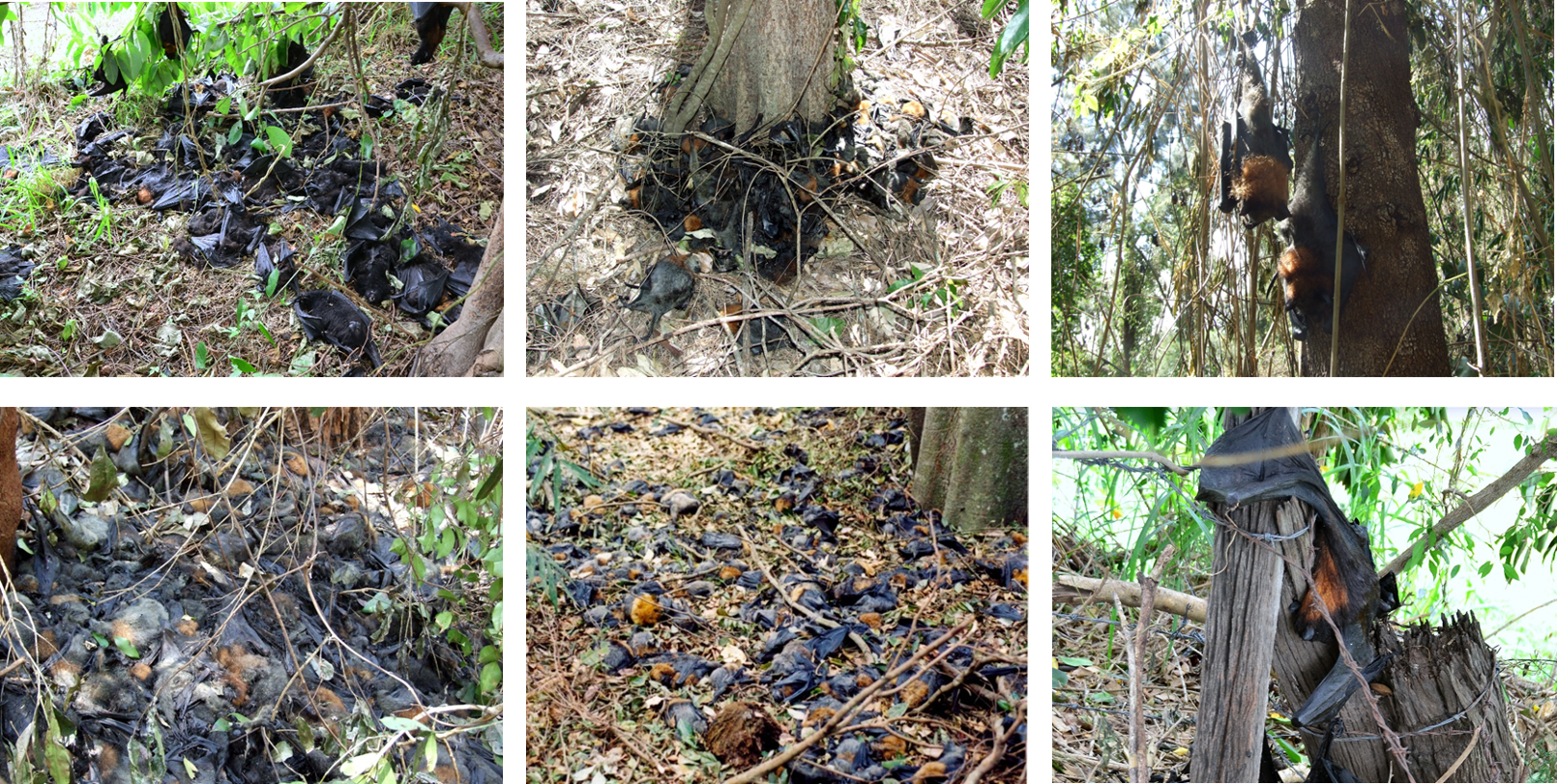
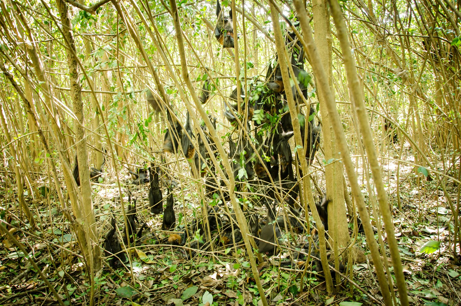
Examples of the dreadful impacts of extreme heat events on flying-foxes
Loading interactive forecasts
Preparing forecast data. You can explore the other pages while this loads.
Camps on alert
This page lists all camps where forecast temperatures indicate flying-fox heat-stress risk during the current seven-day forecast period. Heat stress risk, timing and duration are presented alongside the latest camp counts from the Australian Flying-Fox Monitor and reported field observations to support prioritised camp checks and help coordinate responses.
Alert status categories indicate forecast heat exposure, not confirmed impacts at a camp. Use the prioritised camp list below to identify camps for checking, open a camp to review its forecast and latest available information, and submit an observation after a visit or reliable update. Reports are valuable even when no impacts are observed, because they help distinguish forecast risk from conditions on the ground and keep response priorities current.
Preparing forecast data. You can explore the other pages while this loads.
How to interpret and prioritise the camps listed
Prioritise camps in two steps:
Thermal exposure:
HIGH (≥42°C) before MEDIUM (≥38°C). Within each category, give greater priority where peak temperatures are higher, thresholds are reached earlier, and exposure lasts longer.
Animals exposed:
Consider the latest AFFM count and its date. Larger recent counts indicate that more animals may be exposed, while older counts should be interpreted increasingly more cautiously.
Recent field reports of heat-stress behaviour, mortality, or assistance needed should raise a camp’s priority.
Reporting observations
, including when no impacts are observed, are essential for keeping this prioritisation current by showing where impacts are occurring, where assistance is needed, and where forecast risk has not yet translated into observed harm.
Report observations
Timely reports help coordinate the response. During extreme heat events, establishing which camps have been checked, when they were checked and what was observed is a major undertaking. Shared reports can reduce duplicated visits and help direct limited effort towards camps without recent information or where impacts and follow-up needs have been reported.
Select a camp on the map to view its current heat-stress forecast, latest Australian Flying-Fox Monitor information and recent field reports, and to submit information from your visit.
Select your camp and view its dashboardSelect camp and view dashboard
Search or select a marker to open the camp-specific map and dashboard in one step.
Use this when your camp is not shown on the map
Background information
01
Flying-foxes and extreme heat events
Flying-foxes are charismatic, very large species of bat that forage by night and roost by day in arboreal roosts that can comprise tens of thousands of individuals. They provide important ecosystem services, including pollination of wild and cultivated crops and seed dispersal (e.g. Fujita & Tuttle 1991). However, they are exposed to threatening anthropogenic factors (Mickleburgh et al 1992; Abdul Aziz et al 2021), the most serious of which are loss of foraging and roosting habitat (e.g. Tidemann 1999), direct killing of animals in orchards and harassment and destruction of roosts (e.g. Tidemann & Vardon 1997; Welbergen & Eby 2015).
Our research has shown that temperatures exceeding 42ºC cause mass mortality among flying-foxes at landscape scales, with profound effects on the behaviour and ecology of the species. These extreme temperature events affect some flying-fox species more than others, with the more tropical P. alecto showing higher rates of mortality than the more temperate P. poliocephalus. The events are also age-class and sex specific, with dependent young and lactating females predominantly affected.
So far we have found evidence of at least 39 flying-fox die-off events in Australia, with the earliest dating back to 1791, but the majority (35) occurring since 1994. At least 28 events had a death toll in excess of 1,000. In these 28 substantial events, over 233,300 flying-foxes died, with >200,000 deaths recorded in the last decade alone. Currently, flying-fox die-offs occur between 0-5 times per year, but these events are expected to escalate under climate change, with disturbing implications for flying-foxes and other organisms in Australia and beyond.
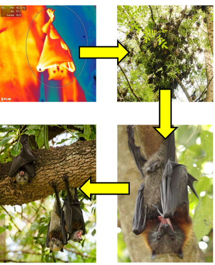
Flying-foxes show a predictable sequence of thermoregulatory behaviours with rising temperatures: wing fanning, clustering, salivating and panting. Beyond 42ºC, thermoregulatory mechanisms become overwhelmed and this is soon followed by death.find out about our heat stress research!
02
The Flying-Fox Heat Stress Forecaster
Animation showing forecasted temperatures in eastern Australia, mapped from
Australian Bureau of Meteorology
computer model data.
Flying-fox camp locations, species and count records are obtained from the Australian Flying-Fox Monitor (AFFM). The Forecaster displays the latest available count and the date on which it was made, allowing users to interpret forecast heat-stress risk in the context of both the number of animals last recorded and the currency of that information. By connecting camp records, short-term heat-risk forecasts and field-based response information within a common spatial framework, the wider AFFM architecture also supports more coordinated monitoring and response.
The weather and AFFM data sources are checked independently during each hourly processing cycle. When a new Bureau of Meteorology forecast or updated camp information becomes available, the forecast grids are processed in R, linked to the current camp frame and validated before replacing the previously accepted forecast. The Forecaster identifies camps predicted to experience air temperatures at or above 38°C, when heat stress becomes likely, and at or above 42°C, when mortality becomes likely.
Each successful update generates the interactive national map, hourly and daily forecast playback, camp-specific temperature profiles, predicted threshold-crossing times, information on camps on alert and downloadable map products. Failed or incomplete updates do not replace the last validated forecast.
The scientific basis and original evaluation of the Forecaster are described by Ratnayake et al. (2019) in Animal Conservation. The operational system has since been substantially updated, including its weather-data source, forecast horizon—which has increased from three to seven days—camp-data source, automated refresh process and interactive outputs.
The forecasts are intended to support preparedness, camp checking and response coordination, but they do not replace local observations or professional judgement. They are based on landscape-scale computer-model weather predictions rather than direct measurements within roosts and may therefore under- or overestimate maximum temperatures at individual camps. Because camp occupancy can also change rapidly, the Forecaster may include camps that are unoccupied or omit occupied camps not yet represented in the underlying data. It should therefore be used as a decision-support tool, not as a guarantee of local conditions or outcomes.
For general maps of impending heat waves with implications for human health and infrastructure, see the Heatwave Service from the Bureau of Meteorology.
About the Flying-Fox Heat Stress Forecaster
The Flying-Fox Heat Stress Forecaster is a decision-support tool for heat-stress preparedness and response. It combines forecast weather data with flying-fox camp information to identify camps that may experience heat-stress conditions and to support shared situational awareness.
Purpose
The Forecaster supports preparedness and coordinated response to extreme heat by identifying flying-fox camps likely to experience heat-stress conditions up to seven days ahead. It helps wildlife rehabilitators, land managers, councils, researchers and other responders decide where and when camp checks may be most valuable, interpret forecast risk alongside the latest camp information, and share observations so limited effort and resources can be directed efficiently to where they are needed most.
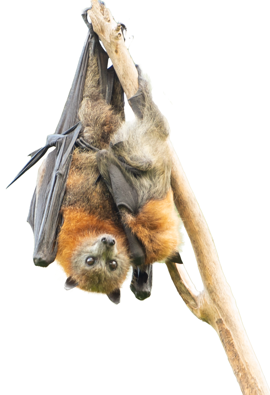
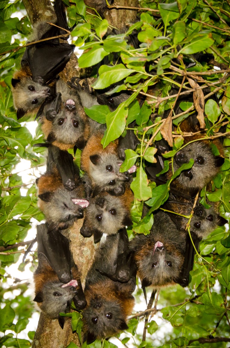
Image from a heat stress event at Emu Plains (NSW) in January 2013. All heat-stressed individuals in this cluster of young grey-headed flying-foxes survived 47o C
Hourly air-temperature forecasts are obtained from the Bureau of Meteorology's Australian Digital Forecast Database. The weather source is checked during each hourly processing cycle, and new forecasts are processed and validated before replacing the previously accepted forecast.
The Forecaster identifies camps predicted to experience temperatures at or above 38°C, when heat stress becomes likely, and at or above 42°C, when mortality becomes likely. These are landscape-scale model predictions rather than direct measurements within roosts.
Flying-fox camp locations, species and count records are obtained from the Australian Flying-Fox Monitor (AFFM). The latest available count and its date are displayed so users can interpret heat-stress risk in the context of both the number of animals last recorded and the currency of that information.
The AFFM source is checked during each hourly processing cycle, allowing new or updated camp information to be incorporated when forecast products are next rebuilt. The wider architecture links long-term camp records, current forecasts and field observations to support shared situational awareness and coordinated response.
Funding
All the work to date on the development of the Flying-Fox Heat Stress Forecaster has been done in-kind without external funding support.
Access to the Australian Digital Forecast Database is not free for us and costs us approximately $5,257 per year.
The original Forecaster was developed as a collaboration between Western Sydney University, the University of Melbourne and the Australian Bureau of Meteorology. The current seven-day operational Forecaster—including its redevelopment, AFFM integration, automation scripts, web interface, testing, deployment and ongoing maintenance—was designed and implemented by Justin Welbergen.
Current Forecaster
Justin Welbergen
Conception
Justin Welbergen, Luke Shoo, David Karoly and Mike Kearney
Historical scripts
Mike Kearney, Himali Ratnayake, Pallavi Govekar and Stewart MacDonald
Historical web design
Justin Welbergen and Himali Ratnayake
Historical data support
Bureau of Meteorology, NCI and National Flying-Fox Monitoring Program contributors
Collaborating organisations
Disclaimer
Forecasts are based on landscape-scale computer-model weather predictions, not direct measurements inside roosts. They may under- or overestimate maximum temperatures at individual camps and may include unoccupied camps or omit occupied camps. The Forecaster is decision support, not a guarantee of conditions or outcomes.